Strait of Magellan map, 1671 Stock Image
by WHPics
Description
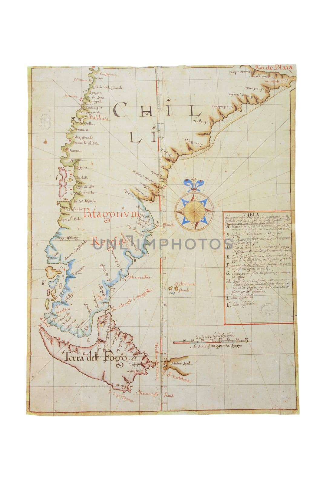
Strait of Magellan map, 1671. Southern tip of South America, discovered in 1530 by Ferdinand Magellan. General Archive of Indies, Seville
Legal
- Editorial License
Keywords
- Strait of Magellan map
- cartography
- 1671
- 17th Century
- spanish possessions
- Latin America
- South America
- General Archive of the Indie journey
- frigate
- English patache
- flat-bottomed boat
- navigable sea route
- southern Chile
- separating mainland
- South America
- Tierra del Fuego
- natural passage
- Ferdinand Magellan
- Todos los Santos
- narrows
- unpredictable winds
- currents
- Drake Passage
- Cape Horn
- Beagle Channel
- Atlantic
- Pacific